Saturday, November 16, 2013

Nov 16 2013

Christchurch NZ, November 16 2013

This morning we visited our neighbor on Ross Island, New Zealand's Scott Base.  The view along the drive was fascinating.  Part of sea ice surface was wavy - like ocean waves at the beach, while other areas are hummocky.  These are pressure ridges created as the ice is pushed against the shore or against other ice.
Pressure ridges in the sea ice.  Notice the fuel line (lower right of the image) supplying fuel to the planes on the Sea Ice Runway (not visible in this image).  

Scott Base is named after Captain Robert Falcon Scott who led two expeditions to Ross Island in 1901-04 and 1910-13.  Captain Scott's team arrived at the South Pole in 1912 - they were not the first to get there.  The Norwegian team led by Roald Amundsen had gotten to the South Pole first.

Scott Base was set up by Sir Edmund Hillary during 1957-1958, the International Geophysical Year (IGY).  IGY followed from the International Polar Years 1882-1883 and 1932-1933.    During IGY, research broadened from astronomical studies to include geophysics.   US's Amundsen-Scott South Pole Station, England's Halley Research Station, Japan's Showa Station were set up in Antarctica during IGY as well.  (Mauna Loa Observatory on Hawaii and other stations were set up during IGY as well).  World Data Centers were set up for the first time during IGY - to archive all the observations and to make them available for everyone to analyze.  More recently we had the International Polar Year 2007-2008.  Scientific research is greatly enhanced during these years, as scientific expeditions and research programs are coordinated among nations, and the data are shared.

All buildings at Scott Base are painted "Chelsea cucumber green".

This afternoon, we left on the LC17 jet (5 hours ride) back to Christchurch, and onto home tomorrow.  The plane was less crowded than the one that brought us to McMurdo.

It has been a most memorable week.  I came away totally in awe of Antarctica; of the scientists who work to understand the geology, the atmosphere, the ocean, the ice, and the biology of Antarctica; and of the men and women who make the science happen in such a far-away and challenging environment.


Nov 15 2013

McMurdo Station, November 15 2013

Today we stayed on McMurdo Station and toured the operation of the station.  

First, the support for the scientific research in the field is utterly enviable and unmatched anywhere.  Sometime in northern hemisphere spring, scientists who will be in the field in the southern summer fill out a form of all their requirements - tents, sleeping bags, axes, crampons, ropes, drill bits, batteries, cookstoves, ... whatever.  When they arrive in McMurdo, all their gear are in their "cage" waiting for them!  Imagine that!

A cage of equipment ready for a scientific party.


Every one offsite is tracked, and needs to report every day - or else a helicopter is dispatched to check if everyone is OK...

Wow!  McMurdo Station is truly a prototype in sustainability.   Needless to say, recycling and re-use is ferocious.


Fuel is brought in, and held in tanks, each of which is surrounded by berms so that any accidental spills will be contained and not contaminate the ocean.  There is a great demand for fuel - not only for powering residents, laboratories etc., but also for the planes, vans, snowmobiles, fire trucks etc... All fuel lines are insulated, and lie on top of the ice - miles and miles of it.  Waste heat is used to heat the water.  There are solar panels, but obviously they are not much use in the winter.  Scott Research Base, the New Zealand station "next door" has several wind turbines, and they share power with McMurdo.  On a good day, the wind power supplies 40-50% of the energy at McMurdo.

Sea water is pumped from the ocean, and salt is extracted via reverse osmosis.  This supplies freshwater for the entire station of about 2000 summer residents.  25% of the "fresh" water is held back from use, and the extracted salt is put back into the water (and the waste water) and returned to sea.  This way there is no injection of extremely salty water that may damage marine life.

The sewage treatment plant was fascinating.  The nitrogen cycle in action - nitrification and denitrification.   UV light is used to disinfect the clarified water, which is returned to McMurdo Sound.

One end product of the sewage treatment -
clarified and disinfected water - is returned to McMurdo Sound.
What surprised me is that the final nutrient-rich "sludge cake" is dehydrated and packed in cartons for shipping to an incineration in the US (via the tanker that arrives in the summer).   Tomato seeds sprout in the sludge cake.
Sludge cake being dehydrated for shipment to a US incinerator.
We ended the tour at the Chapter of the Snows, with a very unique stained glass window.
See the penguin?

Thursday, November 14, 2013

Nov 14 2013

McMurdo Station, Nov 14 2013

Today we visited a polar desert.  We flew from McMurdo Station across McMurdo Sound (and the McMurdo Ice Sheet) to the Dry Valleys.  The Valleys are narrow valleys in between very high mountain ranges, and block the passage of the tongues of the East Antarctic Ice Sheet (Taylor Glaciers, Ferrar Glacier and others) from entering the McMurdo Sound and the Ross Sea.  We visited scientists setting up stream-gauge measurements at the base of the Canada Glacier.  


We flew to Bull Pass, which is a spectacular place for studying erosion.  Weird boulders sandblasted by wind and broken up by freeze-thaw. 


Boulders carved by wind wand water.
On the ground are marvellous examples of freeze-thaw process.  Water is denser than ice, and so when the water in the cracks of the rocks freezes, the ice expands the cracks.


Rock split by freeze-thaw.

We then flew to the edge of the McMurdo Ice Shelf.  The ice at the edge is about 5 feet thick.  We walked to the ice edge, went on our knees (very important), and a family of Emperor penguins came out of the water to check us out!  Emperor penguins are very curious animals and they are not afraid of people.
Conference of Parties at the Ross Ice Shelf


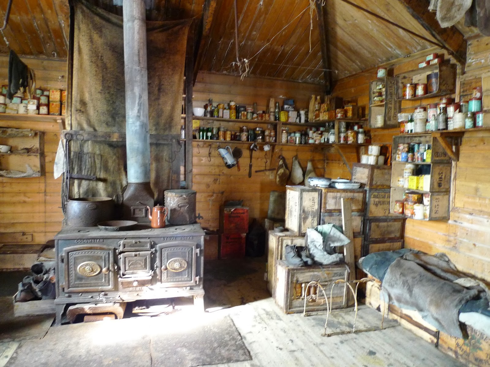
From there, we flew across the Ice Shelf and McMurdo Sound to Cape Royds, home of an Adelie Penguin colony, and the hut of Ernest Shackleton erected by his Nimrod Expedition (1907-1909).  This was Shackleton's base as his party explored Antarctica.
Inside Shackleton's hut  
Shackleton's hut.  Note the dog kennels in front of the horse stalls.


It was an unforgettable day!  In contrast to yesterday's trip to the South Pole - with all the latest scientific instrumentation and equipment - today's trip drove home the power and beauty of Nature.


Wednesday, November 13, 2013

Nov 13 2013

McMurdo Station, November 13 2013

This morning we left for the South Pole in a cargo plane - the C130.  The C130 has landing skis instead of landing wheels.  The plane was packed with cargo and researchers.  We were the last to board the plane - there were no more seats, and so two of us sat behind the pilots in the cockpit.  They were kind and gave me the pilots headset so I could listen to their conversation.  As the plane started taxi-ing on the sea ice runway, it slowed down, just like at SFO when the planes queue to take off.  But we were the only plane on the runway.  

"Penguins on the runway!"  Two emperor penguins were "waddling" on the runway.  We sat there and waited for about 20 minutes for them to get off the runway. We finally took off for the South Pole.
Penguins on the runway!


There are multiple very impressive installations at the South Pole.  At the South Pole Science lab, the projects include IceCube (neutrino detection), South Pole Telescope, seismology.  I met the people working in the Atmospheric Research Observatory.   The CO2 concentration at the South Pole was 393.98 ppm yesterday.  I was given a vial of SPO air.   They were planning to launch a balloon tomorrow to measure the vertical profile of ozone.  Too bad I had to miss it.

The South Pole is marked ceremonially by a reflective sphere on a post.  
THE SOUTH POLE!
All's well except that ice is dynamic.   The ice is moving at the rate of 10 meters per year.  So there is a row of flags marking the previous positions of the ceremonial marker.


The red flags mark the previous positions of the ceremonial South Pole marker.  In the distance are the various science laboratories and installations.

Our visit to the South Pole was cut short because of weather. We had to board the plane in the next 10 minutes or else.

Tuesday, November 12, 2013

Nov 12 2013

McMurdo Station, Antarctica.  November 12 2013

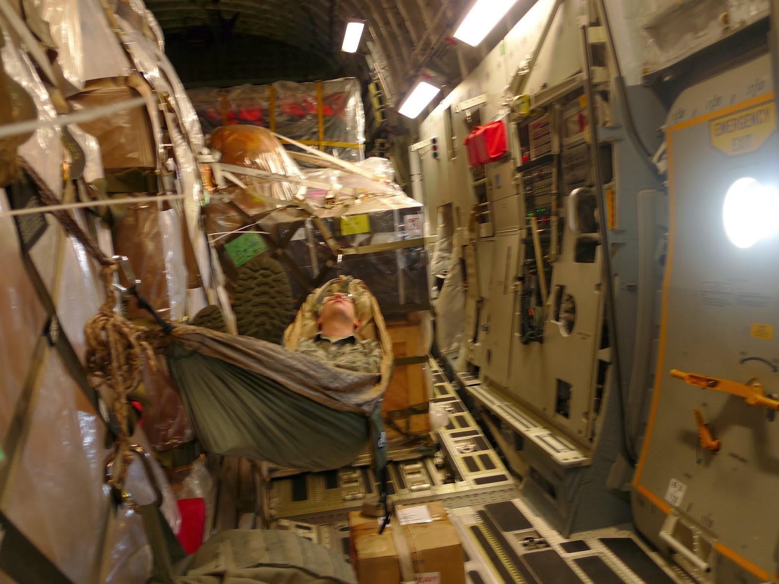
We left Christchurch on the C17 Globe Master around 8:30am this morning and arrived at Ross Island  5 hours later.  The C17 is a cargo transporter.  There is no asking for a window seat on a C17 - there are only two portholes in the cargo-passenger section - for checking the status of the "runway" before the ladder is lowered.  I guess one could make oneself comfortable during the flight. 


I could not tell that we landed on a sea ice runway.  It felt like a regular landing.  We were picked up in a van, and it slowed down as we approached McMurdo Station.  It turns out that the tide is about 0.5 meter, and there is some give in the sea ice at the coastline!
C17 on sea ice runway.  In the summer, the ice thins and this sea ice runway is not usable.  A runway on the ice shelf (far distance) is used instead.

The T-junction is where the sea ice meets the coast.  In the summer, this is a port, and tankers deliver supplies and take away garbage and recycling.
We have sunlight 24 hours a day.

Sunday, November 10, 2013

Nov 11 2013

Christchurch NZ.  November 11 2013

Well.  I am still in Christchurch.

After I finished putting all my gear into the appropriate orange bags (one check-in, one carry-on), I found out at 5:45am that there is a 24-hour delay in departure.

This is the weather forecast by the Antarctic Mesoscale Prediction System (AMPS) at NCAR http://www.mmm.ucar.edu/rt/amps/.  The region of interest is Ross Sea/Beardsmore.  
Below is the forecast is for 00UTC Nov 11 2013, close to the time of our scheduled landing on the sea ice.   UTC=Coordinated Universal Time, previously known as Greenwich Mean Time.   Christchurch and McMurdo are 13 hours ahead of UTC.


There is a low pressure system in the Ross Sea.  Winds are clockwise around the low (in the southern hemisphere).  There are strong winds that bring cold air from the continent to the ocean.  Air over the ocean is moist --> condensation and low clouds.   Important for the decision not to fly is the "hook" of low clouds where we are to land.  


I hope we'll have better weather tomorrow.


Nov 10 2013

Christchurch, NZ.  Nov 10 2013

Today we went to the US Antarctic Program Clothing Distribution Center.  I was issued:
3 top base layers of increasing thickness
3 bottom base layers of increasing thickness
2 pairs of long wool socks
2 neck gators
1 balaclava
1 windbloc fleece hat
4 pairs of gloves
1 pair goggles
1 red outer jacket
1 red parka with hood
1 wind pants
1 pair bunny boots

I had everything on (yes!), except the outer jacket, to make sure that the red parka and wind pants can fit over everything.  The greenhouse effect in action!  I warmed up in no time.  You can tell it's me because my name is on the parka.  I gained 20 lbs.

Tomorrow, weather permitting, we'll be flying over the Southern Ocean.  The plane will land on SEA ICE!  The ice is 2.4 meters thick, and the air temperature is -10F at McMurdo Station.   The sea ice runway will operate for only a couple of months in the spring.  When summer comes, they'll have to fly a plane with skis so it can land on the glacier.